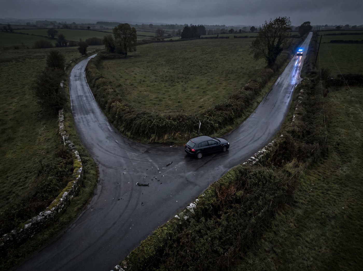
Night aerial view of a collision on a rural Irish road with blue lights arriving
Missions

What arrives in the
first two minutes.

The network exists to close the gap between a call being made and somebody knowing what is actually there. Everything below is what that gap is worth.
Emergency Response
The dispatcher stops working from a description

A 999 call is a person under stress describing something they can only partly see. A caller says there has been a crash on a back road. That is the entire basis for the resource decision, and it is made in seconds.

With an aircraft overhead in about two minutes, the same call becomes a live view. Two vehicles, one of them on its roof, no fire, a queue forming from the north. The decision changes before a single unit is committed.

It changes in both directions. A verified picture can send less as readily as it can send more, and it sends the right thing when it does. Cutting equipment on the way because the view shows a vehicle on its roof matters as much as standing down three units that were never needed.

  • Overhead view before the first vehicle arrives on scene
  • Vehicle count, position and orientation confirmed, not guessed
  • Access and approach seen from above, including blocked routes
  • The picture continues while crews are still in transit
1:29Median response, 10,000 simulated incidents
93.8%Of the country inside two minutes
100%Inside four minutes
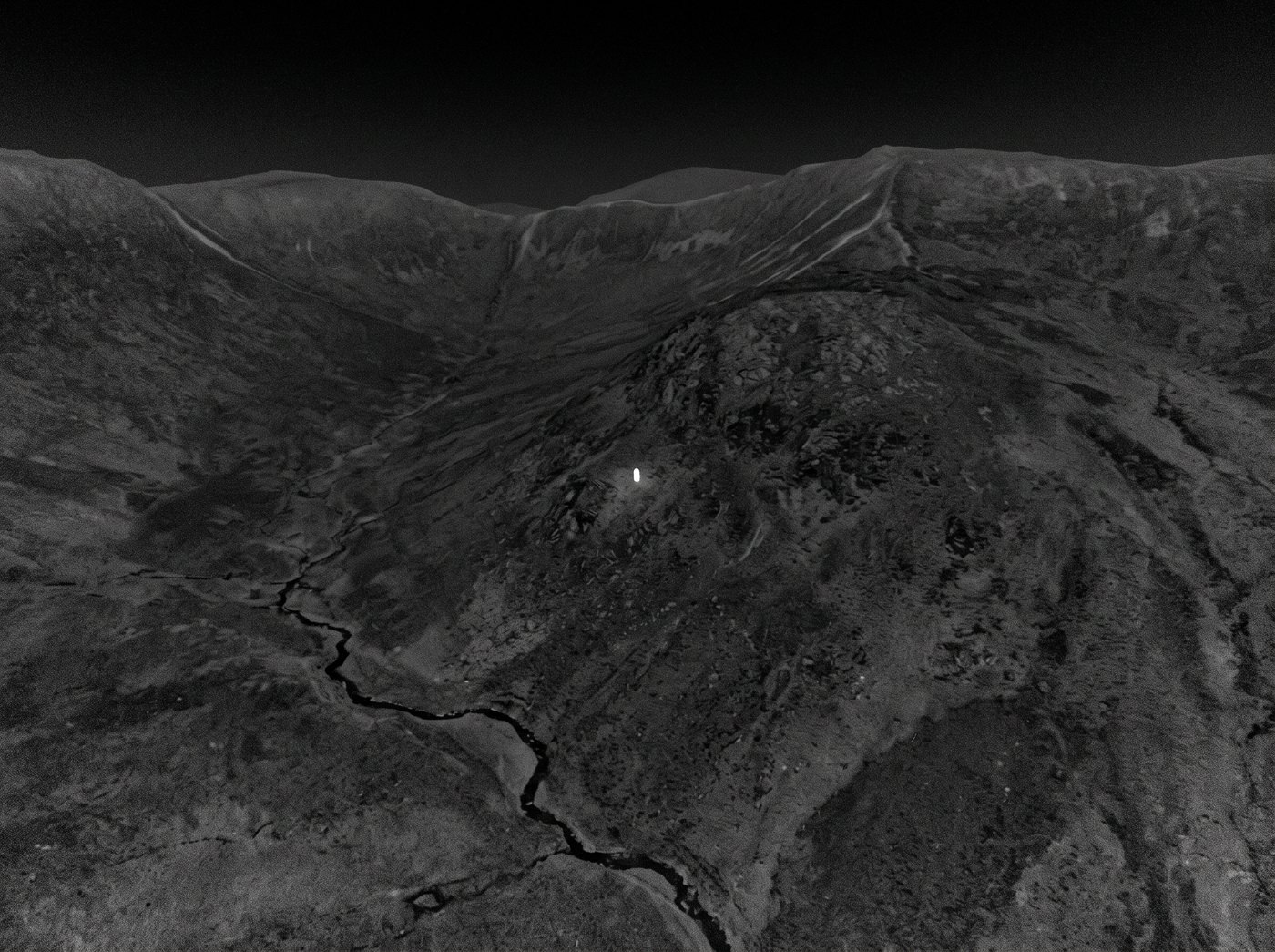
Thermal aerial image showing a single human heat signature on a dark hillside

The area is smallest
at the start.

Search and Rescue
Search area grows with the square of elapsed time

A missing person moves outward from the last known point. The area that has to be searched grows with the square of the time since they were last seen, so every minute spent mustering costs more than the minute before it.

Thermal over the last known point inside two minutes, flying an expanding pattern while ground teams are still assembling, works the problem at the only moment the area is small enough to cover properly.

If the aircraft finds nothing, the ground teams arrive to a search area that has already been cut down and a picture of the terrain they are about to walk into. If it finds something, they arrive with a position.

  • Thermal over the last known point in the first ten minutes
  • Expanding pattern flown while the ground response is forming
  • Terrain, water and access read from above before teams commit
  • Additional aircraft converge as the area grows
Mass

What the grid can put over one point

A single incident is not limited to the station that answers it. Every station within reach can converge on the same point, and the count over that point is set by distance and time rather than by dispatch.

Convergence on one point

Two airframes are overhead by two minutes and 16 to 22 by five. Over Dublin the figure is about 204 by twenty minutes, and about 374 over the midlands.

Endurance sets the ceiling

The limit is the aircraft, not the grid. Beyond about 24 minutes out an aircraft cannot hold station, and that is where the numbers stop.

The links, in order

Satellite primary, with cellular and direct radio to the launch site as fallback. Navigation is visual-inertial with no satellite positioning, and the aircraft flies on full onboard autonomy with no link at all.

Why not a multirotor

A multirotor at 150 km/h flying the same 329 stations reaches 97.7 per cent of incidents inside five minutes. It cannot do two minutes and it cannot mass.

Airspace Awareness
Given a track, return a visual identification

An unidentified track over an airport, a port or a piece of national infrastructure is a question that radar and radio frequently cannot answer. Something is there. Nobody can say what it is.

Given a track from any source, the network puts an aircraft alongside it and returns a visual identification. That is the whole of the mission. Look, and report what is there.

Detection is the constraint, not response. Once a track exists, closing on it is a transit problem the grid already solves. Producing the track in the first place is the harder half, and it is not solved by flying faster.

Anything beyond observation requires an authenticated human decision. The aircraft cannot generate that decision, cannot infer it and cannot proceed without it. If the link is down, the answer is no.

  • Accepts a track from any source, produces a visual identification
  • Observation only, with no autonomous action on what it finds
  • Human authority required for anything past looking
  • Reports back and returns to station
The operating principle
The Three Missions

One network, three jobs

How a service starts

From first conversation to running

The national figure of 329 stations is what full mainland coverage at two minutes costs. Nobody starts there. A service starts with one area and one set of missions, and the same arithmetic is run against it.

01

Assess the service area

Take the area to be covered and the response time it needs, and work out what the grid has to be. Site count falls with the square of both time and speed, so five minutes is a very different network to two. Relaxing the national target from two minutes to five takes 329 stations down to 36.

02

Site the stations

Find the high ground. Nationally, 36 of the 329 sit on existing summits or the broadcast mast estate, where power, access, security and planning are already solved. The remaining 293 need a tower, a water tower or a municipal rooftop. The same survey runs at county scale.

03

Trial one county

Stand up a working grid over a single county with real call outs and real crews, and measure it. The regulatory route is the European specific category with an operational authorisation, with a lead time measured in years, so that work starts in parallel with the trial rather than after it.

04

Operate

Two airframes per station, held unattended and ready. What is learned in the first county sets what the next one looks like. Coverage extends by adding stations to a grid that is already running, not by rebuilding it.

Start with one area

If you run an emergency service, a search and rescue organisation or a piece of national infrastructure, the first conversation is about your area and your response times. We will run the numbers against them.

Contact Us