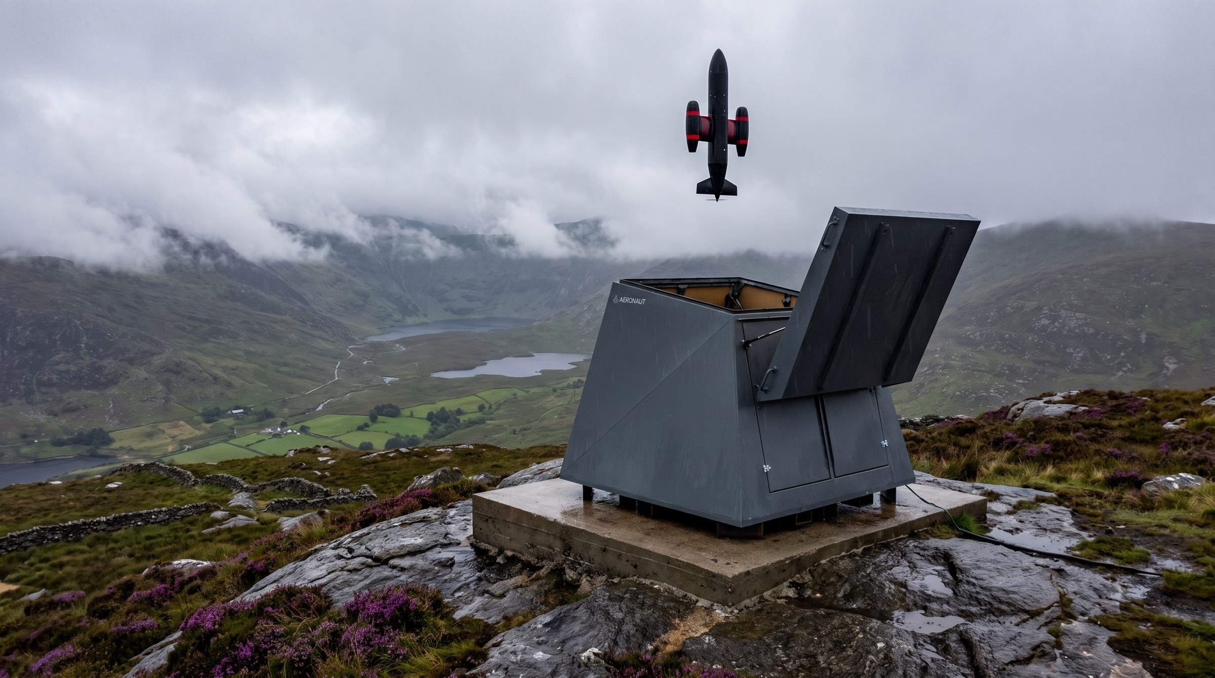
A call comes in. A lid opens on a hilltop within 9 km of the incident. An aircraft lifts out, turns onto the bearing, and arrives before anyone has finished writing down the address. Everything on this page exists to make that sequence repeatable, unattended, at 329 sites, in Irish weather.

The requirement sets the airframe. To cover 9 km in the 90 seconds left after the lid opens and the aircraft climbs, cruise has to be 360 km/h. To be useful once it arrives, the aircraft has to stop and hold station above a junction, a hillside or a shoreline for as long as the incident lasts.
A multirotor cannot hold both ends of that. Speed on a multirotor is bought with attitude, the whole aircraft tilts into the airflow and every rotor works harder to carry the weight it was already carrying. Push it fast enough to matter and endurance collapses at exactly the point the mission needs it, on scene, hovering, before the crew has arrived.
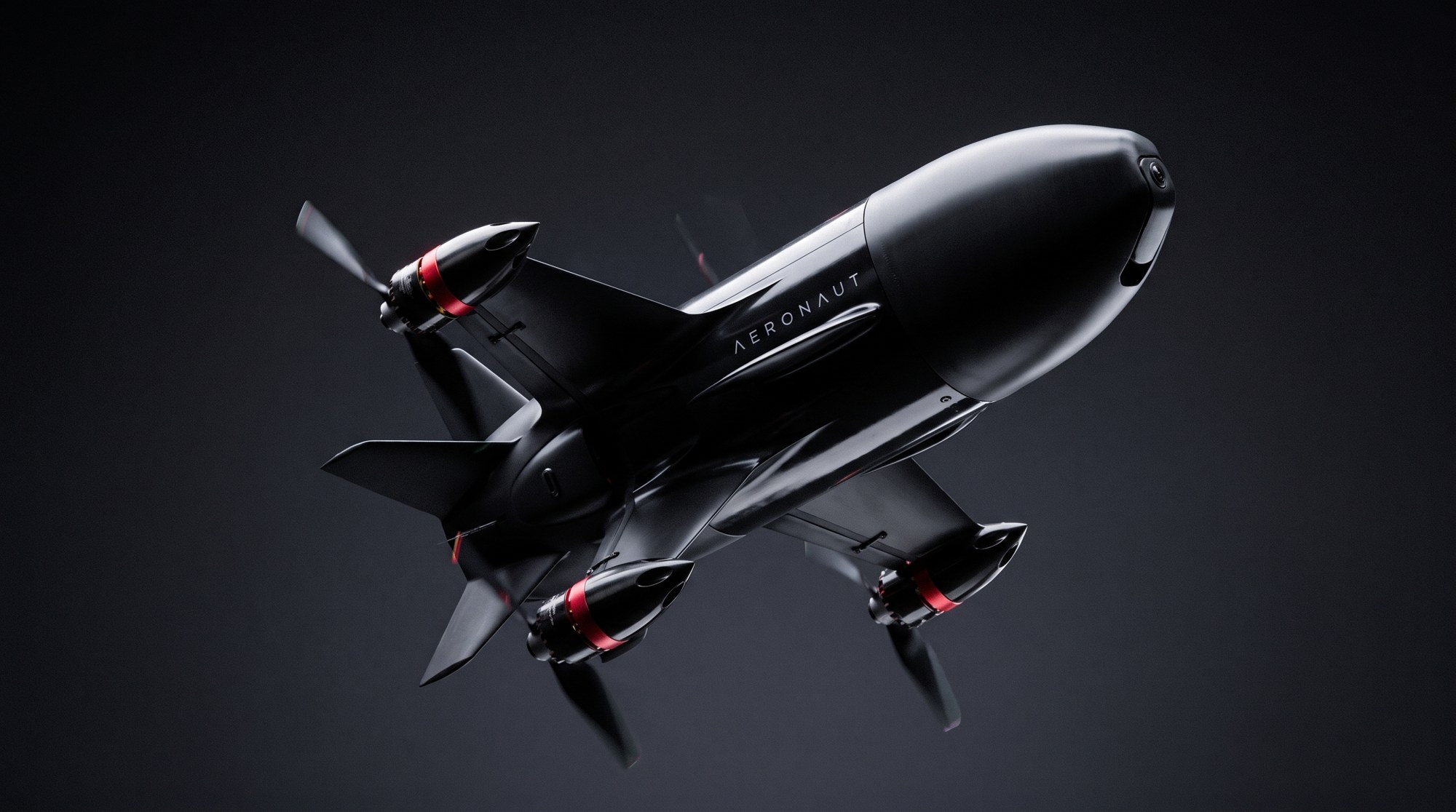
A tilt-rotor separates the two jobs. It lifts vertically out of the box on four wing-mounted nacelles, tilts them forward, and transits on the wing where the lift is free. Over the scene it tilts back and hovers. The transit is a wing problem, the hold is a rotor problem, and neither is compromised to serve the other.
The airframe is a bullet fuselage with a swept main wing, a cruciform tail and four nacelles on the wing. Two aircraft sit in every station, 658 in total, so a site can respond and still have an aircraft ready, and a single incident can be given two viewpoints from one launch point.
The comparison is measurable. A multirotor at 150 km/h flying the same 329 stations reaches 97.7 per cent of incidents inside five minutes. It cannot do two minutes, and it cannot mass on a single point.
The station is unattended. It is weather sealed against everything an Irish summit does in February, it keeps both airframes charged and ready, and on a call the lid opens and the aircraft lifts straight out. There is no crew to roll, no vehicle to load, no door to unlock. The 30 seconds between the call and the climb are the whole of the ground procedure.
Of the 329 sites in the lattice, 36 sit on existing summits or on the broadcast mast estate. The remaining 293 need a structure, a tower, a water tower or a municipal rooftop, each already at height and already in someone's ownership.
Co-location on the existing broadcast transmission estate solves four problems at once. Power is already there and already conditioned. Access roads exist and are maintained to reach a summit in winter. The sites are fenced, monitored and secured. And the planning position for a structure on an established transmission site is a different conversation to the planning position for a new mast on a bare hilltop.
Kippure, Mount Leinster, Truskmore, Mullaghanish, Cairn Hill, Clermont Carn, Three Rock and Woodcock Hill are high ground that is already serving the country. The network sits on top of that work rather than repeating it.
Communications are built in layers rather than in a chain, so that losing one does not put the aircraft in an unplanned state. The last layer assumes every other one is gone.
The primary link. Wide area coverage that does not depend on the terrain between the aircraft and the ground, which matters over mountain, bog and open water.
The first fallback. Where the network reaches, and over populated ground it usually does, the aircraft has a second independent path back.
A direct link back to the launch site it came from. Within the 9 km the aircraft was built to cover, that path is short and under our own control.
Visual-inertial navigation, with no satellite positioning, and enough onboard capability to complete the task and land safely with nothing talking to it.
That is the design rule, and it is what the fourth layer is for. An aircraft that treats a dropped connection as a failure will eventually fail at the worst moment, in weather, in a valley, over water. An aircraft that navigates by what it can see and what it can feel does not need to be told where it is. Position comes from the aircraft's own cameras and inertial sensors, so jamming or the loss of satellite positioning changes nothing about its ability to fly, find the scene and come home.
This is the operating principle of the network and it is not negotiable. The aircraft navigates, launches, transits, finds, identifies, holds station and returns on its own. Anything beyond observation requires an authenticated human decision the aircraft cannot generate, cannot infer and cannot proceed without. If the link is down, the answer is no.
The separation is architectural, not a policy written down somewhere and trusted to hold. The flight system and the decision path are built as different things with different authority. The aircraft has everything it needs to fly itself to a scene and stay there. It does not hold, and cannot be given in the air, the authority to act on what it finds. There is no configuration that grants it, no operator setting that unlocks it and no degraded mode that lets it pass. A missing human is not a delay to be worked around, it is a stop.
Launch, transit, navigate, arrive, find, identify, hold station over the scene, return to the station and shut the lid. All of it without a person in the loop and without a link.
Anything beyond observation. That decision has to come from an authenticated human, and the aircraft has no path to manufacture one, infer one or continue without one.
Policy can be revised, overridden or forgotten under pressure. Architecture cannot. Putting the boundary in the design means it holds on the worst night rather than only on paper.
Start from the response time and work backwards. Two minutes, of which 30 seconds is opening the box and climbing, leaves 90 seconds of transit. At 360 km/h that is 9 km. So every point in the country has to be within 9 km of a station.
Covering a surface with equal circles at the lowest possible count is a solved problem, and the answer is a hexagonal lattice. Laid over the 70,273 square kilometres of the Republic mainland at a 9 km spacing, it comes to 329 launch stations. That number is not a target or an ambition. It falls out of the geometry once you fix the time and the speed.
The sensitivity is worth understanding, because it explains why nothing like this exists yet. Site count falls with the square of both time and speed. Relax the requirement from two minutes to five and the same country needs 36 stations rather than 329. Nine times fewer sites for three extra minutes.
The same squaring works in the other direction. A slower aircraft needs far more stations to hold the same clock, which is why the airframe and the site count are one decision rather than two. Two minutes nationally is expensive, and it is expensive for a reason that is arithmetic rather than engineering.
The lattice was tested against 10,000 simulated incidents drawn across the mainland. Median response was 1 minute 29 seconds, 93.8 per cent of the country was inside two minutes, and all of it was inside four minutes.
The regulatory route is the European specific category, with an operational authorisation. The lead time is measured in years. There is no version of this where that is not true, and we would rather say so than imply otherwise.
So it runs in parallel with the first county trial rather than after it. The alternative, building the case on paper and only then flying, wastes the years twice over and produces an authorisation argued from assumptions instead of from flight data. A single county gives the regulator real operations to look at, in real weather, against real calls, while the authorisation is still being written. The evidence and the application grow together.
If you work in emergency response, in the mast estate, in aviation regulation or in the department that would own this, we would like to talk about where the first trial goes.
Contact Us